Showing posts with label Washington road trips. Show all posts

Saturday, March 15, 2014

WAWeekend: ‘Coasting’ in Washington

We are in the betwixt and between travel season . . .

KoOlina2013 013
KoOlina - O'ahu, Hawaii

. . .not quite ready to give up the afterglow of winter in Hawaii and just about ready to start packing for our return to Greece later this spring. . .

GreecePt12013 025
Pireaus, Greece April 2013
. . .so we decided to head to the Washington State Coast for a quick getaway this last week.

OceanShores2014 261
Ocean Shores, Washington State


Iron Springs Alderbrook 2012 016
And did we ever time it right!

Although still brisk enough to wear a jacket, we had sunshine and blue skies – every day!!

The photo to the side illustrates what the coastline usually looks like: wet and rainy. In fact, that was the weather two years ago when we visited Iron Springs Resort on Copalis Beach. This year we stayed a few miles south in the city of Ocean Shores.


OceanShores2014 215
View from Quinnault Resort - Ocean Shores

Both times we’d gone to the shore to watch the winter storms and each trip held its own kind of beauty; one showing the gray foreboding wet, wild side of the sea and the other its cheerful bright side.

Iron Springs Alderbrook 2012 038
Dogs and Drivers are welcome on Washington State Beaches

We’ve decided it is impossible to pack the correct clothes because you never know what might greet you. Once on a near 80-degree sunny mid-July day in Seattle we headed to the beach only to find it fogged in and so chilly we turned around and came home instead of pitching the tent in which we’d planned to spend the night.

Travel DEAL:

Generally, The Scout, seeks out the ‘deals’ but sometimes they appear in our inbox as well, as did this offer from Iron Springs Resort, a collection of cabins on a beach side bluff that were purchased, refurbished and reopened two years ago. 
PicMonkey Collage
Interior of one cabin at Iron Springs Resort

They are so nice that it was difficult to pass them up this trip to try something new, but reluctantly, we did.  However, had this deal been going on I know we wouldn’t have been able to pass it up:

Three nights for the price of two!
April 1, 2014 - June 15, 2014
Enjoy two nights at Iron Springs and we’ll spring for the third*! 
(Call 360.276.4230 or 1.800.380.7950 for details)
*The Three for Two package is available for stays between Tuesday, April 1, 2014 through Sunday, June 15, 2014. Offer not valid for stays between May 23, 2014 through May 26, 2014. Additional nights available at our standard seasonal rates. Standard taxes, cleaning and dog fees apply. Reservations made prior to March 11, 2014 are not eligible for this special. Book this package by calling 360-276-4230 or 1-800-380-7950. Online booking not available for this promotion.

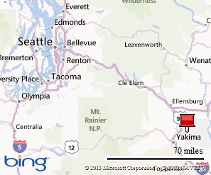
If you go:  Ocean Shores and Copalis Beach are about a two hour drive from Seattle. 

Stay safe where ever your travels take you this weekend.  Thanks for the time you spent with us today.   Hope you’ll join us again on Foodie Tuesday – when we are serving up a taste of Greece. 
And  if you aren’t receiving our posts in your inbox, just sign up in the box to your right to do so – it is free.

Saturday, July 27, 2013

WAWeekend: On the Spirits and Ale Trail

A couple years ago I visited the Yakima Valley researching a Washington Ale Trail travel article for the Seattle Times and followed a customized ‘ale trail map’ I’d developed for myself. 

ChelanToppPort2010 104
That’s because the tourism folks in this cradle of Central Washington’s wide open spaces and agricultural lands didn’t have such a document. . .but, they promised, it was coming.

ChelanToppPort2010 107

They did have ‘wine road’ maps because those producers of the grapes and the makers of the vino are pretty much the headliners of the area – and have been for the past few decades. That wasn’t of much use because I was on the trail of ale. . .

MooCardAleTrail 072

The hop – the basic ingredient of ales – has been grown in the Yakima Valley for decades. High school chums used to earn spending money by ‘stringing hops’; twirling those twisty little shoots around the strings that would lead the vine skyward as the summer continued. Hop kilns, those enormous bigger-than-barns wooden structures used to dry the hops at harvest time dotted the landscape.

ChelanToppPort2010 105
Hop Vineyards in the Yakima Valley
Here’s  the kicker: 78% of the hops grown in the United States are grown in the Yakima Valley!

MooCardAleTrail 087
American Hop Museum - Toppenish, WA

International visitors make treks to the American Hop Museum in the small Lower Yakima Valley town of Toppenish but not a lot of folks on this side of the state or elsewhere, I suspect, even know of its existence. (It is well worth a visit if you’ve never been there!)

MooCardAleTrail 084
Hop cluster

Back to those tourism folks and that map they promised. . .just this week I got a news release with a link to:

 The Yakima Valley Spirits and Hops Trail website which has that promised map, a list of upcoming events, ‘sip spots’ and ‘guzzle and grub’.

Kudos to those folks because it’s an amazing piece of work and will serve any visitor well! Click the link above and check it out.

Here’s a couple of the events you’ll find listed there:

Annual Apple Valley Kiwanis Wine Country Trek Sat.– Sun., September 28 - 29

A scenic two-day, 120-mile bike ride, round-trip from Yakima to Prosser, through vineyards, hop fields and orchards. Start time from Yakima on Saturday is 8:00 a.m. returning Sunday at 6 p.m. Registration is $135 per cyclist with all proceeds going to Kiwanis community and youth service projects. This event coincides with the Hot Air Balloon Festival and the Harvest Festival in Prosser. Registration includes our famous gourmet dinner, the balloon glow, overnight camping (indoor and outdoor) in Prosser, Sunday morning breakfast, baggage transportation and break stops. For information, visit www.kiwaniswinecountrytrek.com

MooCardAleTrail 073
Finished product: ales


Attendees at the 11th Annual Fresh Hop Ale Festival can enjoy selections from numerous participating breweries in addition to brewing demonstrations, a cigar tent, food from local restaurants, live music and street dancing. The Festival begins at 5 p.m. and will continue until 10 p.m. Ticket prices are $30 if purchased in advance and $35 at the gate. All proceeds benefit Allied Arts of Yakima Valley which coordinates art programs, classes and events for the community. Pre-sale ($30) tickets are on sale at local businesses around the Yakima Valley during regular business hours through noon on Friday October 4. Plenty of tickets will also be available for $35 at the gate. Ticket price includes a commemorative beer glass and $6 scrip (used instead of cash for beer and wine, but note that food is cash only and that the event is 21+ only. ID is required for entry. For more information, visit www.freshhopalefestival.com

If  You Go:

Map picture

There are daily flights from SeaTac (Seattle Tacoma International) to  Yakima. Driving time from Seattle is about three hours to the Lower Valley;  little more than two hours to Yakima.

That’s it for this weekend’s focus on Washington State.  As always thanks for the time you spend with us. Hope you’ll tell friends to come along on our journeys together.  They can sign up to receive the posts  by going to the home page, www.travelnwrite.com.

And a request to our Facebook followers:  if you have a post that you particularly like, please ‘share’ it on your page – that what keeps the page in circulation!
Happy and Safe Travels~

Saturday, July 6, 2013

WAWeekend: From ‘Blogosphere’ to Mt. Baker

Would you believe it took a Canadian, who lives in South Korea to get me to Mt. Baker, in northern Washington State for the first time in my life?

Washington, the place I’ve lived my entire life, I might add.


And, I have the blogosphere to thank for planting the seed some two years ago that made this trip happen.

Regular readers know that each week TravelnWrite is a part of Travel Photo Thursday hosted by Budget Travelers Sandbox, a blog created by Nancie McKinnon, an educator from Halifax who teaches at a South Korean university. 

Over the year’s Nancie and I have gotten to know each other in the usual blogosphere way; reading posts, making comments,responding to comments and writing occasional emails.

Out of the blogosphere. . .

Nancie, two weeks ago, was en route  to Halifax and made  a stop in Vancouver, B.C. to visit a friend. She suggested we meet somewhere during that stopover. Turns out her friend, Sue, has a vacation retreat at The Glen at Maple Falls, Washington. Nancie further suggested we meet there.

“Sure!” I replied, thinking, “Where in the world is Maple Falls?” Grabbing the map, I found it right at the foot of Mt. Baker.


The day we met was one of those dreary, gray days for which this Evergreen State is known. Intermittent rain, and gray clouds provided the less-than-scenic backdrop as I headed north. 

Summer2013 001

My journey took me over the new temporary bridge span on Interstate 5 (part of the permanent bridge fell into the river after an over-sized truck hit the railing last month).

Summer2013 008

Then east on Highway 20 to Highway 9 (pictured above).

Summer2013 005

Past beautiful meadows, pastureland, and forested hillsides. Well, they would have been really beautiful had the fog and clouds not dulled their emerald sparkle. I traveled through little hamlets named Acme, Clipper and Van Zandt – each calling out for a longer look on a future trip.

Summer2013 004Highway 9 led to the Mt. Baker Highway and a couple miles  more I found myself at The Glen, a gated recreational development near the Nooksack River.

It took about 10 seconds, the length of time it took me to get out of the car, for these two blogosphere friends to fall into easy conversation; it was as if we’d known each other for years.


Summer2013 003

In a way, we have known each other for years – thanks to our blogs which have allowed us to follow the other’s life events and travels. (I have to tell you that for two people who are usually behind the camera, posing for that photo above had us howling with laughter at our discomfort as Sue patiently took photos of us.)

The only disappointing part of the day was that the cloud cover never allowed me even a peek at Mt. Baker, that majestic 10,781 ft.(3,286 m) peak, the third-highest mountain in Washington State and the fifth-highest in the Cascade Range.

But thanks to the courtesy of the USGS for allowing use of that first photo and Nancie, who sent one she took of the mountain a few days after my visit, I can show you one place in the state that you really should visit – especially on a sunny day!

MtBaker

If You Go:
The Mt. Baker area is about a two – three hour drive north of Seattle (depending on your destination). It took two hours to drive from Kirkland to The Glen, just under 100 miles in distance.

It is about an hour from Surrey, British Columbia, which is just outside Vancouver.

Mt. Baker National Forest information:
http://www.fs.usda.gov/mbs
The Glen at Maple Falls information:
http://theglenatmaplefalls.com/

Wednesday, July 3, 2013

Red, White and Blue Road Trip

Happy Birthday America!

While citizens and cities drape themselves in our patriotic colors on the Fourth of July – our holiday commemorating the signing of the Declaration of Independence from Great Britain in 1776  – we decided to take ourselves on an armchair Red, White and Blue road trip through America’s West:

Our trip begins  in Seattle, Washington, where sometimes that old song, “The bluest skies you’ve ever seen are in Seattle. . .” holds true. On sunny days, Elliott Bay, on which Seattle is located,  is pretty blue as well:
0911800-R1-007-2

WARoadTrip2012 040
Heading east across  Washington, we’ll spend a bit of time in Spokane, where red brick buildings stand tall against a blue sky backdrop.

A walk through the town’s historic district is a glimpse back at a segment of state history.


WARoadTrip2012 037


WARoadTrip2012 097From there, we’ll go south through Washington’s wheat fields and agricultural lands. Our route takes us through countless small towns like, Rosalia, population about 600.


White clouds flit across those Eastern Washington blue skies providing a backdrop to its mid-century architecture, like the gas station below.


WARoadTrip2012 090

WARoadTrip2012 127Then we cross the border into Oregon State – our destination  to Wallawa Lake and more hues of white and blue.


Just down the road a splash of red, white and blue wrapped history in the town Wallowa, population 807:


WARoadTrip2012 183

To the west a bit further, near Pendleton, Oregon, we are under those blue skies and white cotton-candy-like cloud formations:

RdTripAZ2WA2012 093

Then south into the  state of Nevada , our route awash with blue and white –

AZroadtrip2012 053

Entering Arizona we see on the horizon a splash of red as the spectacular Vermillion Cliffs Monument area expands before us:

AZroadtrip2012 064

An even more brilliant red is found in the Navajo Tribe’s woven rugs. Artisans continue the tradition of their Native American ancestors as they blend color and design in these works of art. (These were for sale at a roadside restaurant in Northern Arizona.)

AZroadtrip2012 087

Our road trip ends  in Arizona’s Valley of the Sun where even the dessert blooms add to our patriotic palette of colors:

PicMonkey Collage

DC2012 024
That’s it for this Travel Photo Thursday and for Travel Photo Mondays.  To all of you celebrating the Fourth of July, we hope your day is filled with family and friends and decked out in red, white and blue.

Travel Photo Thursday is at Budget Travelers Sandbox, hosted by Nancie McKinnon, and Travel Photo Monday is  at Travel Photo Discovery created by Noel Morata.

Hope to see you back again for Travel Tuesdays and our WAWeekend (that stands for WAshington)  featuring in-state destinations. If you've not yet become a follower or subscriber, hope you'll do so today!


The Western United States:


Map picture

Note: This armchair road trip combines photos from three road trips we have taken through the West.

Saturday, June 29, 2013

WAWeekend: A Taste of Our Northern Neighbor

One of the many good things about Washington State is its proximity to Canada. In Seattle, we are about a two hour drive or 30-minute flight from British Columbia, our next-door neighbor to the north.

So when news from Richmond, BC, a suburb of Vancouver arrived in the inbox last week, it tickled our taste buds enough to make us think about heading north this summer. And here are but a few samples of why the temptation is great. . .

RS9411_Dining - Night Market - Asian 7

Sweetly flavored mini-donuts. Skewered seaweed.
Squid pancakes. Roasted yams. Fresh duck wraps.
Sweet mango and cream. Chinese dragon’s beard candy.
Swirly hurricane fries. Japanese takoyaki.
Spicy BBQ squid. Grilled beef or chicken skewers.
Vietnamese salad rolls. Burgers with sushi rice buns.
Japanese corn dogs. Smoked turkey legs. BBQ abalone.
Grilled lobster.Chinese noodles and dumplings.Butter chicken. Soba noodles with savory toppings. Stinky tofu. Shaved ice . . .

. . .are among the goodies found at:

Richmond’s two acclaimed Asian night markets -- The Richmond Night Market and the International Summer Night Market. The two markets combined offer nearly 150 food stalls, more than 400 retail vendors and a variety of entertainment to their more than 15,000 visitors each weekend.

Night Market 2013

Richmond Night Market
Open: May 17 until October 14, 7 p.m. to midnight Fridays and Saturday, 6 to 11 p.m. Sundays and holidays.
Location: 8351 River Road next to Bridgeport Station on the Canada Line.
Cost: Admission is $2 or, buy a transferable Zoom Pass - $10 for 7 tickets or $20 for 15. Seniors and children 10 and under are free. Parking is free.
Get there (by transit): Take the Canada Line to Bridgeport Station and then walk about 200 meters west along River Road to the market.
Get there (by car): Head north on No. 3 Road at Bridgeport Road and follow the signs.
Website: http://www.richmondnightmarket.com/


RS9862_Entertainment - Night Market  15 

International Summer Night Market
Open: May 10 through September 8, 7 p.m. to midnight Friday and Saturdays, 7 to 11 p.m. Saturdays and holidays.
Location: 12631 Vulcan Way just west of the Knight Street Bridge.
Cost: Admission is free. Parking is $4, or purchase a transferable parking pass – 5 for $15 or 10 for $25.
Get there (by transit): Take the Canada Line to Bridgeport Station and then catch a free five-minute shuttle ride to the market (starting June 8).
Get there (by car): Head north on No. 5 Road at Bridgeport Road, turn right on River Road and then follow the signs.
Website: www.summernightmarket.com
There’s a free shuttle between the two, so you can easily visit both in a single evening.

081608 - Richmond, BC
Chung Chow photo
Richmond Summer Night Market
Each weekend throughout the summer 300 vendors selling a wide assortment of products and food items.  The largest venues of its kind attract some 14,000 people.
James Chu cooking up satays for the masses.

Our friends at Richmond Tourism offer these tips for enjoying the markets to the max:
* Bring cash. Although some merchandise vendors accept debit cards and there are ATMs on site, it’s easier for everyone if you can pay with cash on the spot.
* Be prepared to haggle with the merchandise vendors, but not at the food stalls.
* To avoid the crowds, come on Fridays and Sundays and arrive early.
* For the most action-packed fun, come on Saturdays and stay late.
* For the best deals, come on Sundays, especially late in the evening when vendors are trying to sell as much stock as possible before the weekend is over.
* Don’t be daunted by the longest food lineups – they’re long because the food is good. Besides, they move more quickly than you think.
* Expect to spend between $2 and $8 on most food items.
* Note that pets (dogs and cats only) are welcome.
* Neither market is licensed, so no alcohol is sold on site.

If  You Go:

Drive time from Seattle: About two hours depending on International Border Crossing wait times. Passport/Citizenship documentation required:  http://www.dhs.gov/crossing-us-borders

Map picture

Accomodations:

The two markets are near several hotels. The Richmond Night Market is steps from the River Rock Casino Resort Hotel or a short walk to the Westin Wall Centre.

The International Summer Night Market is a little further over from these two hotels – a 5 minute drive. Or, there is the Sandman Signature Hotel, a bit closer. All the hotels are 5-10 minutes from the markets.

For more accommodations and information: www.tourismrichmond.com

Photos used in this post were provided to us by Tourism Richmond. And a reminder to all of you using Google Reader to read TravelnWrite. Time to find a new reader and we are on both BlogLovin' and Digg these days. Google Reader is being discontinued this weekend.

Sunday, June 23, 2013

WAWeekend: Having a blast on Snoqualmie Pass

It was a blast on Snoqualmie Pass that led to this post.  Quite literally.

ChelanManson 027

Ellensburg 014
Snoqualmie Pass, about an hour east of Seattle, was once the hunting ground and homeland of the Native Americans tribe, the Snoqualmie (snow-qwal-me).

It now the highest point on  Interstate 90, Washington’s major east-west link.

Road improvements near the pass’s 3,022-foot high summit are prompting sporadic road closures of an hour or so and reduced speeds. 

Thursday evening’s blasting tossed and tumbled so many boulders onto the roadway that crews were still feverishly working hours later  to open the roadway by mid-Friday morning. 

That would be the same Friday as my scheduled one one-day road trip to Eastern Washington.

Ellensburg 011

I was among the hundreds of travelers who were waiting for the road to open. The good news was that I’d reached the summit’s recreation/rest area just minutes before the backup stretched beyond its exit.
Ellensburg 007

Ellensburg 009The summit at one time had little more than a Rest Stop.
  
Today,that same rest stop has been joined by ski areas and their lift stations, a vacation home development, a hotel and several coffee shops, one of which is located in the historic rest stop.


Ellensburg 006

That café/store, Red Mountain Coffee, (pictured above) was doing a brisk business. 

Next door, in the entry hall to the public restrooms, the state has mounted a framed narrative of the history of Snoqualmie Pass. And quite a history it has:  

In June 1858: Seattle area men, believed to be miners, cleared a trail to Lake Keechelus,  ([pictured below) just east of the summit.
WAFebMarch2012 003


Ellensburg 003
1865– 1867:The trail was widened and could then accommodate wagons, although weather destroyed it regularly requiring it to be rebuilt. It also required travelers to ferry across Lake Keechelus.  (Some on-line sources say portions of the old wagon road can be seen from the area’s Denny Campground.)

1884 – 1887:  An Ellensburg company improved the road further – but travelers had to pay a toll when using it.

Ellensburg 004

1905:The first auto drove over the pass on what was then called, Sunset Highway.

1934: the roadway was paved.
AZroadtrip2012 003

Roadway improvements continued and in 1981 the roadway lanes were split with west bound opening west of the Snoqualmie River and Denny Creek on a bridge span 200-feet high.

Ellensburg 012

2005 – 2017:  The state Legislature approved the  Transportation Partnership Account gas tax, which secured $551 million to improve the first five miles of the corridor to the east of the summit (notorious for snow slides that often close the road in winter).

The work involves adding a lane in each direction, replacing deteriorating concrete, adding and replacing bridges and culverts, extending chain up/off areas and replacing the snow shed (think open air tunnel over the freeway) just east of the Snoqualmie Pass Summit with another structure to reduce winter avalanche closures.

This portion of the project is scheduled to be complete in 2017.

If You Go:

Map picture

Expect delays and reduced speed areas when traveling over Snoqualmie Pass.  Blasting continues and schedulesfor closures resulting from it  – as well as road conditions – can be found at the Washington State Department of Transportation, click WSDOT.

Have you ever hit a road block on a road trip?  What did you do while waiting to resume your travels?

That’s it for this weekend. Hope you are having a good one what ever road you are following. . .come back soon!

LinkWithin

Related Posts Plugin for WordPress, Blogger...