Showing posts with label Boomer road trip. Show all posts

Thursday, May 4, 2017

Greek Road Trips: Finding the Menalon Magic

Our destination was Dimitsana, population 340.

Clinging to a hillside overlooking the Lousios Gorge in the Menalon Mountain range of the Peloponnese, the small hamlet lies northeast of Kalamata.

We’d chosen it to be our introduction to the area from among a dozen such small villages that are scattered across the region known as Central Arkadia (are-cod-EE-ah).

P1030708
Dimitsana, Peloponnese

Lonely Planet’s guidebook describes it as ‘a tangle of precipitous ravines and narrow roads that wind their way through the medieval-village-speckled valleys of the Menalon Mountains. . .where you’ll find some of the most breathtaking mountainous scenery in the Peloponnese.’ 

P1030659The guidebook described it perfectly. But it didn’t prepare us for the lush forested peaks that rise from those magnificent gorges nor for the charm of its villages. I've caught myself wanting to use the word 'charming' in every paragraph of this post.

The guidebook could also have described it as:

'a magical land straight out of a fairy tale’.


P1030681
Amanites Guesthouse, Dimitsana - Our room with a view
The first part of the trip is on the national highway, a slick divided four-lane route, that links Kalamata to Athens. Our adventure began after leaving that freeway as we set out on roads so narrow in places and without guardrails that we were relieved when the only on-coming traffic was a herd of goats.

As the road became rougher, and thinking this place really was remote, we realized we’d taken the wrong turn back at the village with the castle (I said it was a fairy tale setting so of course there would be a castle). Once we got on the right road (which was narrow but well maintained), it didn’t take long to reach our destination.

P1030665
Oncoming traffic in Greece's Arkadia region

Each of the roads had taken us through several picturesque towns each it seemed with an ancient castle, or bell towers or church or fortress.

PicMonkey Collage
Villages in Central Arkadia - Peloponnese
We had afternoon cappucinos in a captivating village named Stemnitsa, population 200, home to a gold and jewelry college. Items created there are sold throughout Greece. The village is also known to outdoor enthusiasts from around the world because of. . .

P1030673
No better place to sip a cappuccino than Stemnitsa, Peloponnese

The Menalon Trail

P1030746
Menalon Trail Map
The area’s a magnet for outdoor enthusiasts who are hiking all, or parts, of the 72.5km Menalon Trail that stretches between the villages of Stemnitsa  and Lagkadia.

The well-signed trail, completed in May 2015, offers eight sub-section hikes. One of the most popular is the 12.5 km route from Stemnitsa to Dimitsana. That route takes hikers past two Monasteries – each worth a visit.

We didn’t bring day packs and hiking poles, hats and gear for tackling the route, but having seen the area, we plan to return and explore at least a part of it one day.


P1030716
Lousios Gorge, Central Arkadia

Destination Dimitsana

P1030714
Gunpowder Mill - Dimitsana
We did – thanks to the advice of friends -- visit the village’s Open Air Water Power Museum (now don’t quit reading or start snoring here!). 

We are glad we took their recommendations – it was a great trip back into the area’s pre-industrial past.

Paying the 3-euro per person admission we toured the restored grounds and mills of the long-ago bustling Agios Yiannis (St. George) mill. It is 1.6 km from the village, a nice taster-sized hike or you can drive and park at the site nestled into the side of the gorge. We watched the water-run flour mill operate as well as the nearby gunpowder mill. (Ammunition was produced here for the Greek War of Independence.)

P1030684
New upscale bars and bistrots line old cobble-stone streets in Dimitsana
Coffee shops, upscale bars and restaurants – so many from which to choose that we couldn’t try them all in a single two-night visit.  And the view of the the gorge from those overlooking it, drew us back each night to sip and savor the view.

P1030690
8 p.m. sun was just setting over the Lousios Gorge - we had a front row seat
There are guesthouses and hotels in several of the villages.  We chose Amanites Guesthouse, an 8-room boutique hotel recommended by Lonely Planet guidebook. We had a delightful room with a view (note photo above) and our 70-euro a night rate included  a buffet breakfast the featured homemade jams and spreads, a variety of bread and pastries, eggs, cheeses, fruits and vegetables.

P1030757
Breakfast buffet included at Amanites Guesthouse hotel - Dimitsana
While warm weather brings hikers to the area, winter snow draws the big city dwellers. If you are traveling between Athens and Ancient Olympia, this is a great scenic route to follow.

If we’ve teased your travel bug with this post, here are some sites you might find of interest:
Map picture
Menalon Trail, www.menalontrail.eu
Open Air Water Power Museum www.piop.gr
Amanites Guesthouse www.amanites.gr
Dimitsana is less than two hours drive from Kalamata.

That’s it for this week’s travels in Greece. We thank you for the time you spend with us and love hearing from you.  And thanks to those of you who’ve been recommending Travelnwrite to your friends! Hope you’ll be back next week and until then safe travels to you and yours.

Linking this week with:
Through My Lens
Our World Tuesday
Wordless Wednesday
Travel Photo Thursday
Photo Friday
Weekend Travel Inspiration

Tuesday, November 29, 2016

Monemvasia ~ The Spirit of Place

'Spirit of Place' (or soul) refers to the unique, distinctive and cherished aspects of a place.
-- Wikipedia


On a hauntingly still November night, we spoke in hushed voices as we made our way along the twisting, dimly lit stone pathways that serve as streets here.  Our footsteps, our words, our mere breathing seemed to amplify and bounce off the stone walls and walkways. Homes were shuttered and most businesses had closed for the season so there really was no one to disturb as we made our way through the darkened village. 

Cruise ships were no longer stopping for brief visits and bus loads of tourists that can fill the tiny streets were finished for the season. The village was settling in for a winter's hibernation. We were among maybe a handful of tourists who'd opted for a late autumn visit. As we made our way down to the seaside and back the only sounds were an occasional stray cat's cry or the rustle of drying leaves. After the sun had set, following the village's maize of uneven pathways, and stairs became a game of discovery as we'd turn a corner and find ourselves in a small plateia, plaza, or sometimes at the entry of someone's private home. . .never quite the place we thought we'd be.

On this dark autumn evening we were walking through history and surrounded by what Lawrence Durrell would likely call, 'the spirit of place'. We were in Monemvasia, a centuries-old village in the Greek Peloponnese.


P1030179
Monemvasia, Greek Peloponnese

Referred to as Greece’s 'Gibralter' by some, its name, Monemvasia (mah-nem-VAH-sia) means 'single passage' and dates back to a time of Venetian occupation here. The Venetians are credited with building a single paved walkway to the landmass that is said to have broken from the mainland during an earthquake back in 375 A.D.  They called it 'Napoli de Malvasia', the French named it 'Malvoise' and English writers have referred to it as 'Malmsey'.  By whatever name, it is one of our favorite ‘finds’ in the Peloponnese and a favorite road trip destination.

Today a paved road on a 200-meter-long causeway leads to its entry gates. You can park along the causeway or back in Gefira (Yefira) or New Monemvasia on the mainland.  Visitor accommodations can be found there or within the walled city itself, often referred to as the Kastro, or castle.


P1030205
Monemvasia from the sea

We opted to stay in the old town and couldn't help but get caught up in its history which is as much a zig-zag affair as the twists and turns of its pathways.

brief history (I'm leaving out many details): Founded by the Byzantines in the 6th Century, it remained under their rule for 700 years until the Franks came along and took over. Then another round of battle and the Byzantines got it back. In 1419 the Venetians came along and later sold it to the Ottomans in 1715 but then came the Russian-Turkish War in the 1700's. . . and finally. . .in the summer of 1821 it became part of the Greek State.

In more modern history it played a role in World War II with the New Zealand 6 Brigade successfully evacuating from there and the Germans using it as a place for injured soldiers to recover.

P1030257
Donkeys and humans with hand-carts make deliveries here
To visit this wonderful old walled city, you do need to be able to walk - and walk on uneven surfaces.  In fact walking is a reason to visit the city that was built on two levels; the lower level on which we stayed and explored and the upper level at the very top,  known as the Fortress of Goulas, where there are ruins of homes and cisterns and a still-standing St. Sophia, Byzantine Church. 

The upper level has been under restoration since our first visit some four years ago. It has recently opened to visitors, but hadn't at the time of our visit.

Traveling through the lower village you will be sharing the right of way with burros and humans with hand carts who transport products and goods  through its narrow passageways.


P1030227
Stray cats charmed the few remaining tourists
Even with the upper level not open during our visit, we were able to burn some calories as we explored its winding routes. One route lead high above the village, not quite to the fortress level but high enough to afford us some spectacular views  none-the-less.

P1030247
A passageway in Monemvasia

With its expansive views of the sea and protected location we could understand why so many wanted to claim it as their own through the centuries.

P1030233
View from above the village
Heading out in a different direction and angle we followed a path and stairway combination that lead us to the water's edge.

P1030208
Seaside in Monemvasia

“It is a pity indeed to travel and not get this essential sense of landscape values. You do not need a sixth sense for it. It is there if you just close your eyes and breathe softly through your nose; you will hear the whispered message, for all landscapes ask the same question in the same whisper. 'I am watching you -- are you watching yourself in me?' Most travelers hurry too much...the great thing is to try and travel with the eyes of the spirit wide open, and not too much factual information. To tune in, without reverence, idly -- but with real inward attention. It is to be had for the feeling...you can extract the essence of a place once you know how. If you just get as still as a needle, you'll be there.”
Lawrence Durrell, Spirit of Place: Mediterranean Writings edited by A.G.Thomas


PicMonkey Collage
Our accommodations

While many hotels were closing for the season, The Scout, had done his research and found us this stand-alone suite right in the heart of town for a mere 45-euros a night. We had a restaurant right across the street, and two coffee shops a quick walk away.

P1030230
Monemvasia, Peloponnese

We marveled at the mix of old and new. Our suite offered Wi-Fi and modern amenities yet we were in an ancient building. The remains of some buildings in the village look as if they'll barely stand another second, yet we know they'll likely be around much longer than we will.  The oldest church in the village, St. Paul's, was built in 956 and houses its museum (well worth a visit!).


P1030222
Modern restaurants and stores fill ancient structures
On the day we sipped coffee on this roof-top, the wind was brisk but the views were spectacular.


PicMonkey Collage
Hidden treasures around every corner in Monemvasia

If you go:
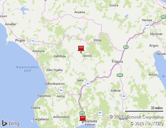
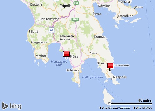
Monemvasia is about 190 miles from Athens, or a five hour drive.  From our home (an hour south of Kalamata), we made the near 80 mile drive in just under three hours. Roads in the Peloponnese are pretty much two-lane non-divided highways so driving times take a bit longer than you might expect.

Greek KTEL buses travel daily from Athens Kifissos bus station to Monemvasia via the cities of Sparti or Molai, and the trip will take about five hours. To get to the Kifissos bus station take bus 51 from Omonia or X95 from the Athens Airport.


Map picture

That's it from The Stone House on the Hill this week. We love having you join us on our part-time ex pat adventures in Greece and greatly appreciate the time you spend with us. Hope you'll be back again next week and until then our wishes for safe and happy travels to you and yours ~

Linking this week with:
Through My Lens
Our World Tuesday
Wordless Wednesday
Travel Photo Thursday
Photo Friday
Travel Inspiration


Tuesday, October 18, 2016

The Greek Peloponnese ~

The Peloponnese or Peloponnesus is a peninsula and geographic region in southern Greece.
It is separated from the central part of the country by the Gulf of Corinth.

Peloponnese.  Say the word out loud and it seems like a jingle: ‘pell-oh-POE-naize’ or ‘pell-oh-poe-NEE-sos’, depending on your nationality and your pronunciation.

It is the place we’ve called our part-time home since buying our The Stone House on the Hill two years ago. And for as well-known as it seems to be among Northern Europeans who vacation and have homes here, the place seems relatively unknown to a vast majority of Americans.

“Which island?” is the question we are asked in the U.S. Pacific Northwest, by those who’ve learned of our new lifestyle. Their brows wrinkle, hmmmm, they ponder a moment, “No, not quite sure where that is.”

P1020047
The Stone House on the Hill to the right of the boat mast
My response is a bit of a show-and-tell. “Not an island” and hold my hand up, outstretched fingers pointing down and say, “It is the peninsula that looks like a hand. You cross the Corinth Canal to get there from Athens.”

IMG000
Peloponnese Peninsula looks like an outstretched hand


I suspect many of you - at least those in the U.S. - will be surprised to learn that Lonely Planet’s Travel Guides named it the number one tourist destination in 2016. That was huge news around here last spring. Since we've returned this fall we are hearing nothing but positive reports from those in the tourist industry (airports, restaurants, car rental agencies):

"Best year since 2007 (for home sales)" - local realtor
"Still have cars coming in and going out daily - best year in a long time" - car rental agency
Arrivals at Kalamata airport up 22% this year over last

DSCF8171
Scenes of the Peloponnese
                                                1. The Peloponnese, Greece
Travellers to Greece tend to flock to the myriad islands or marvel at the iconic Acropolis, but one of the country’s most diverse, vibrant regions is often forgotten: the Peloponnese. It remains an affordable enclave of magnificent ancient sights like Olympia, Mycenae and Mystras, which are scattered across a rich landscape of stone villages, teal seas and snow-capped mountains.


-- Lonely Planet Travel Guide  

You history buffs will find so many ancient sites that it will require either an extended stay or many visits to see them all. . .Achaia, the seaside gate to Western Europe, Ancient Messinia, Ancient Olympia (birthplace of the Olympics), Mycenae, and Corinth (you travel over the the Corinth Canal if you come here from Athens). And unless you visit in the height of the summer tourist season, you’ll find most are not over-run by tourists even though tourism is on the upswing. We had the tomb pictured below to ourselves the day we went exploring:

PicMonkey Collage
History is there for the asking - usually for no entry fee
While not being history scholars or buffs, we’ve come to appreciate – even be awed by – the amount of history that surrounds us in every day life.  Villages scattered about the hillsides are treasure-troves of antiquity. With far too many to be listed in tourist guides, you simply happen upon them as you travel the narrow roadways that lace the peninsula. The chapel below was open on Easter Sunday at the restaurant where we celebrated the day with our neighbors.

P1000582
A small church up the road from our house
Churches that have served the faithful for centuries are still used for worship. Church bells still call the faithful to services and remind us all of the importance of the Greek Orthodox religion here.

P1000561
Through the ages. . .
Reminders of the conflicts that have marred the area’s history are also prevalent in the villages. The building architecture often tells the story of history’s conquerors. Take the Venetians who battled the Ottomans for control of the area. Evidence of their occupation carved into stone – their Winged Lion of St. Mark, a symbol of the Venetian empire spotted on buildings and entries throughout the area.'

P1030107
The Venetians were here. . .
Many visitors though are drawn to the area – much as we were – by its striking mountains and views of the sea.

P1030061
A walk along the Sea in The Mani
For others, it is the charm of the stone villages, some still requiring you to park your car and walk into their interiors because their ancient streets are so narrow.

P1030257
The Main Road in Monemvasia - be prepared to walk
The Peloponnese is divided into regions, much like you think of counties within states in the U.S. Arcadia, Achaia, Ilia, Korinthos, Laconia, Messinia, where our home is located. . .each has a little something different to offer and we have barely touched the surface.

Map picture
The Peloponnese
During our next few months here, we plan to do some exploring of this vast land and we’ll take you with us, virtually, anyway.  As always, we appreciate the time you spend with us and love reading the comments and emails our tales prompt.  We can’t thank you enough for re-posting and tweeting links to our blog for others to read.  Happy and safe travels to you!

Linking up this week with:

Through My Lens
Our World Tuesday
Wordless Wednesday
Travel Photo Thursday – 
Photo Friday
Weekend Travel Inspiration

Tuesday, September 27, 2016

And then came Moab. . .Utah, that is.

The name Moab is a Biblical name for a land just short of the Promised Land.
The Moabites were historically regarded as the perpetual enemy of the Israelites, "God's Chosen People." Physically, the region was a green, verdant valley in the middle of a serious desert; an emerald in the sand, so to speak. Because of those similarities, our little town was dubbed Moab by Mormon settlers in the 1800's.
                                                                           -- Moab-Utah.com


P1010223
Sunset in Moab, Utah
Our heart rates were finally returning to normal after traveling that breathtaking section of roadway through the Monument Valley. We were headed to Moab (MOE-ab), Utah our own ‘Promised Land’ where after an eight-hour day on the road, we were ready for our two night stay in this small town. We were heading to the Fairfield Inn and Suites, just outside town near Arches National Park for this segment of our Southwestern road trip.

P1010269
Fairfield Inn is dwarfed by the surrounding cliffs - Moab, Utah
At the time we decided to stay there – about two days in advance of the trip -- we didn’t know much about this small town of less than 10,000 residents nestled tucked in alongside the Colorado River in Southeastern Utah. But a bit of on-line research had convinced us it was time to visit – and to give ourselves an extra night there.

P1010221
Colorado River, Moab, Utah
During the 1800’s the area around what is known as Moab served as the Colorado River crossing along the Old Spanish Trail. That 700-mile-long trail is a historical trade route that connected the northern New Mexico settlements of Santa Fe, New Mexico with those of Los Angeles, California and southern California.

P1010267
Moab Valley
The downtown, as with most tourism-oriented towns, is lined with galleries, restaurants and gift shops. There are dozens of retail outlets that focus on the out-of-doors, from selling gear for outdoor adventures to offering tours. The area is an outdoors paradise with whitewater rafting and kayaking on the Colorado River, canoeing on the Green River, mountain and road biking, rock climbing, hiking, backpacking and camping.

Working up a hunger and thirst:

P1010270
The lone food truck in Moab, Utah
With only a single full day we packed as much into it as we could: a visit to Arches National Park, and during the afternoon we tried out the hotel’s pool area and then headed into town to explore its many stores and find a place for dinner. (There is no end to the food options.)

20160902_171922_resized[611610]
Moab - Margaritaville, Utah!
We chuckled at the headline in one of their tourist publications: “How to Get a Drink. . .in Moab, Utah”.  As it was a question that had crossed our minds as we set out on this route.

Utah, with its Mormon population and influence has long been recognized by travelers as a place than can be difficult to find and consume alcoholic beverages. But the times are changing even in this ‘dry land’.  The Moab Brewery – yes, a real micro-brewery in downtown Moab – is the only place in town you can buy full-strength beer to go.  Beer with an alcohol content of 3.2% can be purchased at food stores and convenience stores.

The Utah State Liquor Store is the only retail outlet that sells bottled liquor, wine and beer with an alcohol content above 3.2%. You don’t find the beverages with that alcohol content and above in grocery stores.

However, Moab now has two local wineries:  Castle Creek Winery, located at Red Cliffs Lodge, 15 miles from town on Scenic Highway (The River Road) and Spanish Valley Vineyards, just off Highway 191, south of Moab.  Both wineries have on-site tasting rooms and wine is available for sale.
P1010216
La Sal Mountains - Utah
With only a day we didn’t have time to drive the scenic loop road that would have provided a close up view of the La Sal Mountains, a part of the Manti-La Sal National Forest, just 20 miles south of Moab. With peaks reaching nearly 13,000 feet this alpine ranges is the second highest range in Utah. We also had to put Canyon Lands National Park a bit to the north on the ‘next time’ list.  But we did visit Arches National Park and that’s a whole post in itself.

As always, the time you spend with us is most appreciated! And another big thank you to those who’ve shared our posts on FB with your friends and family there. Hope to see you back next week.

We’ve just returned to our Stone House on the Hill in Greece where we plan to spend the fall. I know a number of you are waiting for more road trip tales from here so as soon as we finish up with the Southwest trip tips and tales, I’ll tell you about some of what the Peloponnese has to offer! And of course, I've got tales to tell 'from the hill'. Safe and healthy travels to you and yours.

Linking up this week with: 

Through My Lens
Our World Tuesday
Wordless Wednesday
Travel Photo Thursday – 
Photo Friday
Weekend Travel Inspiration

Tuesday, September 20, 2016

Monument Valley: “Awesome ~ Simply Awesome”

AWESOME – adjective – extremely impressive or daunting,
inspiring great admiration, apprehension or fear.

“Awesome!” responded the young telephone sales clerk when I placed an order for curtains.

“Will that be all?”  We said yes and the young waitress replied, “Awesome!”

Neither of those things were awesome.  But on our Southwest Road Trip we found something that  really was:

Awesome is the Monument Valley that stretched from Northwest Arizona up into Utah.

We revised our route north while in Arizona's “Valley of the Sun” (as the Phoenix area is known), after reading a travel article in the local paper. The area sounded too good to miss - and it was! 

We were barely 25 miles beyond Kayenta, a small ‘census designated place’ of about 6,000 people (not even a ‘town’) in the Navajo Indian Reservation, when we come over a rise in the road and were met with an ‘AWESOME!’ sight – the kind that gives you goose pimples and a shiver even on the warmest of days.

P1010169
The Monument Valley from Highway 163
We were traveling a stretch of Highway163 that cuts through the vast, remote Monument Valley, a region of the Colorado Plateau famous for its clusters of vast sandstone buttes (the largest reaching skywards for 1,000 feet). This area is part of the 16 million acre Navajo Reservation. The number of outdoor hiking, rafting, horseback riding and camping opportunities are endless. 

There are even two hotels in this somewhat lonesome landscape – The View Hotel and Restaurant and the Monument Valley Trading Post, both just off Highway 163. One warns that because of the remote location, Wi-Fi might be a bit lacking in speed and quality.

P1010174
Monument Valley straddles Arizona and Utah
The Anasazi, the Ancestral Puebloans, are believed to have settled in this region in 120 BCE; the cause of their disappearance is still being speculated upon by historians. Then came the Navajo culture centuries before the Spaniards arrived in 1581.

P1010177
Monsoon season made a lush green carpet on the valley floor
The Navajo Visitor Center is about four miles from the highway. As Monument Valley is a part of the Navajo Tribal Park, there is an entry fee required for those who leave the highway and spend time exploring by jeep, hiking or horseback. All tours can be arranged in advance or at the Visitor Center. 
Entry fee is $20 per car with up to four occupants.  National Park passes don’t work here.

P1010173
Mind-boggling in size and shape - the Monument Valley rock formations
We’d considered staying at one of those two hotels but our last minute itinerary change brought us here the Thursday prior to Labor Day weekend when rooms were scarce and the few that were still available cost many more hundreds of dollars than we wanted to pay. So our 'touring' was limited to the time we spent driving the highway through this wild, usually-sunbaked desert. However, as I told you earlier we traveled in early September at the end of the area's monsoon season which made for lush green landscapes.
P1010175
Monument Valley - Arizona and Utah
In fact rain clouds skirted past and drizzled on us before we left the area.

P1010176
A two-lane highway bisects the Monument Valley
Highway 163 is a two-lane roadway – it was nearly empty on this Thursday afternoon.

P1010193
A mitten perhaps?
The land and monuments are considered sacred to the Navajo. There is something about this place - even just driving through it - that makes you understand why.

P1010182
Monument Valley
While normally road construction delays are a source of frustration, we welcomed the one we encountered just as we were leaving the area.  It gave us a chance to get out of the car, feel the strong desert breeze that was pushing the rainclouds above us and get one final glance at that magical, no, make that, “Awesome!” place – Monument Valley!

P1010197
A long and not so lonesome highway leads to Monument Valley
If you are planning a trip here in the near future check out the Monument Valley Navajo Tribal Park website as it is full of information about accommodations, and guides that have been approved by the Tribe for hire.

P1010183
Up close and awesome!
Monument Valley is 146 miles from Moab, Utah or 380 from Salt Lake City, Utah, 395 miles from Las Vegas. Rent a car and set out on a road trip – it is one you won’t forget!

Our destination that day was Moab and its amazing Arches National Park - an area that turned out to be equally as 'awesome' as here. We'll tell you about it soon. And, as always, we appreciate the time you spend with us and hope that your travels are healthy and happy ones. 

Linking this week with:

Through My Lens

LinkWithin

Related Posts Plugin for WordPress, Blogger...